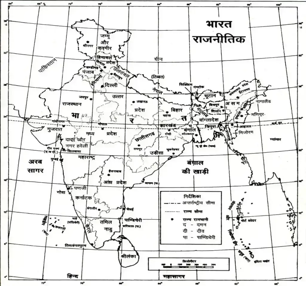
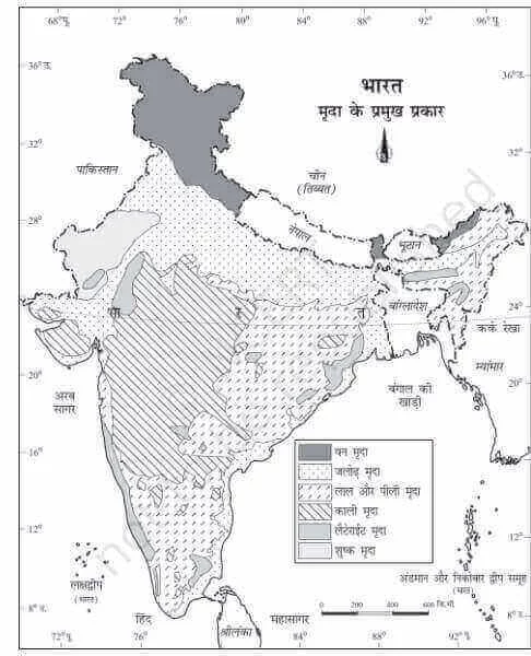
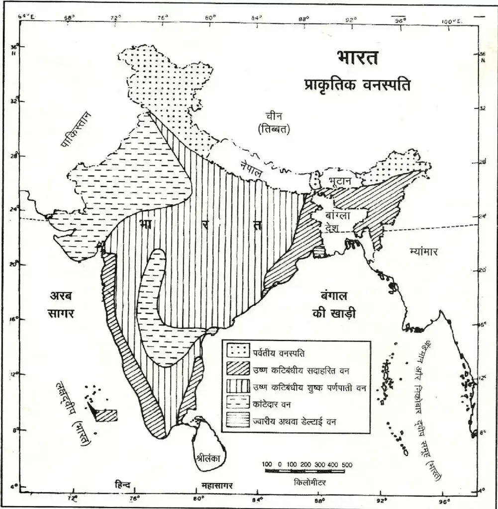
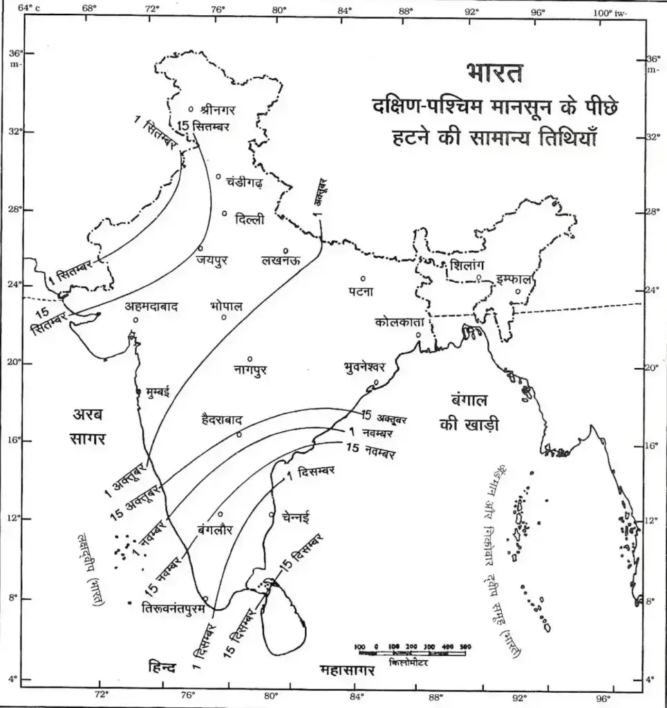
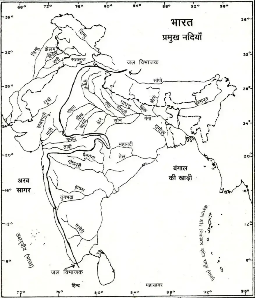
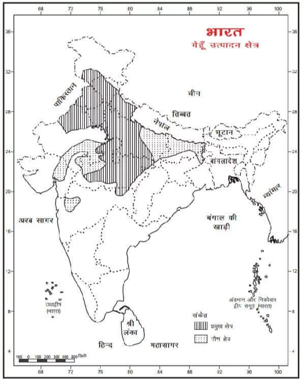
India Land Area – India Can Be Divided Into Five Natural Parts.
Natural Divisions of India
- Mountain Region Of The North
- The Great Plain Of The North
- Southern Peninsular Plateau
- Coastal Plain
- Thar Desert Natural Part Of India
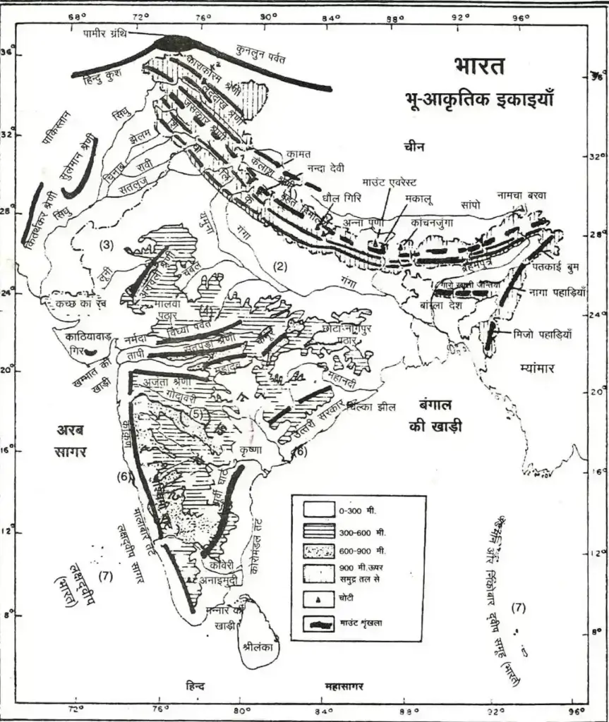
India Land Area » Himalayas
- Himalaya (Him + Alay) Means ‘Abode Of Snow’.
- Its Total Length Is About 5000 Km. And Its Average Altitude Is 2000 Meters. Its Average Width Is 240 Km. And The Area Is About 5 Lakh Sq. Km. Is Of
India Land Area » Geographical Units Of India Map
The Himalayan Mountain Range Is Divided Into Three Parts
The Great Himalayas Or The Himadri
Its Average Altitude Is 6000 Meters.
It Is The Northernmost And Highest Range Of The Himalaya Mountains. All The Highest Peaks Of The Himalayas Are In This Range, Such As- Everest (8850 M.), Kangchenjunga (8598 M.), Makalu (8481 M.), Dhaulagiri (8172 M.), Cho Ou (8153 M.), Nanga Parbat. (8126 M.), Annapurna (8078 M.), Nanda Devi (7817 M.) Etc. Of These, Kangchenjunga, Nangaparvat And Nanda Devi Are In The Border Of India And The Rest Are In Nepal.
Major Passes Of India Are Located In This Range. These Include Shipki La And Baralacha La In Himachal Pradesh, Barjila And Zojila In Kashmir, Neeti La, Lipulekh And Thag La In Uttaranchal And Jelep La And Nathu La In Sikkim.
Mount Everest – 8850 Meters (It Is Called Sagar Matha In Nepal And Kyomolangma In China.) It Is The Highest Peak In The World.
Kangchenjunga – 8598 M (It Is The Highest Peak In The Himalayas In India – In Sikkim).
Lesser Himalayas, Middle Himalayas Or Himachal (Outer Himalayas Or The Shiwaliks)
It Is The Southernmost Range Of The Himalayas. Its Average Altitude Is 1000 M. Is. In This, High Plains Made Of Mud And Pebbles Are Found, Which Are Called Dun Or Dwar (Dehradun, Haridwar), After This The Vast Plain Of India Begins.
Note- India’s Highest Peak Is K-2 (Karakoram) Or Godwin Austin (Height: 8611 M) Which Is In The Karakoram Range And Not In The Himalayas. It Is In Pakistan-Occupied Kashmir And Lies To The North Of The Greater Himalayas.
Apart From The Himalayas, There Are Some Other Mountain Ranges In North-East India.
• Zaskar And Ladakh Range – In Kashmir
• Patkai, Lushai, Garo, Khasi, Jaintia, Bum, Mizo Range – In The Eastern States.
India Land Area » Peninsula Plateau of india
Aravalli Mountains
It Extends From Rajasthan To The South-West Of Delhi. Their Total Length Is About 880 Km. Is. It Is The Oldest Mountain Range In The World.
Guru Shikhar Is Their Highest Peak At 1722 Meters. The Famous Tourist Destination Mount Abu Is Situated On It.
» Vindhyachal Mountain
• This Range Runs From Gujarat In The West To Uttar Pradesh In The East.
It Is A Combination Of Vindhyachal, Bhaner, Kaimur And Parasnath Hills. Vindhyachal Mountain Clearly Separates North And South India. Its Average Height Is 900 M. Is.
» Satpura Mountain
The Satpura Range Starts From Rajpipla In The West And Extends To The Chota Nagpur Plateau.
Mahadev And Maikal Hills Are Also Part Of This Range. 1350 M High Dhupgarh Peak Is Its Highest Peak.
Western Ghats Or Sahyadri
Its Average Altitude Is 1200 Meters And The Range Is 1600 Km. Is Long.
There Are Two Major Passes In This Range – Thalghat (It Connects Nashik With Mumbai) And Bhorghat (The Mumbai-Kolkata Rail Route Passes Through It).
The Third Pass Palghat (Connects Tamil Nadu And Kerala) Separates The Southern Part Of This Range From The Main Range.
Eastern Ghats
It Has An Average Elevation Of 615 Meters And A Range Of 1300 Km.
Palakonda, Annamalai, Jawada From South To North And Hills Under The Eastern Ghats. And Known As The Hills Of Shivrai.
The Highest Peak Of This Range Is Mahendragiri
(1501 M).
Nilgiri Or Blue Mountains
The Nilgiri Hills Are The Meeting Place Of The Western Ghats And The Eastern Ghats.
Doddabetta Is The Highest Peak Of The Nilgiris.
Note :-
In The Far-South Are The Cardamom Hills. These Are Also Called Illamalai Hills.
The Highest Peak Of Peninsular India Is Annaimudi (2695 M) Which Is In The Annamalai Hills.
| Mountain Top | Country | Height Above Sea Level (In Metres) |
|---|---|---|
| Mount Everest | Nepal | 8,850 |
| Kangchenjunga | India | 8,598 |
| Makalu | Nepal | 8,481 |
| Dhaulagiri | Nepal | 8,172 |
| Nanga Parbat | India | 8,126 |
| Annapurna | Nepal | 8,078 |
| Nanda Devi | India | 7,817 |
| नामचबरवा | Tibet | 7,756 |
India Land Area » Major Passes Of India
- Karakoram Pass – It Is Located In The Karakoram Ranges In The Ladakh Region Of The State Of Jammu And Kashmir. Its Elevation Is 5,654 Meters Above Sea Level.
- Zojila Pass – It Is Located In The Jaskar Range Of The State Of Jammu And Kashmir. The Route From Srinagar To Leh Passes Through This Pass. Its Height Is 3529 Meters.
- Pir Panjal Pass – It Is Located In The South-West Of The State Of Jammu And Kashmir. It Is 3494 Meters High In The Middle Of Pir Panjal.
- Banihal Pass – It Is In The South-West Of The State Of Jammu And Kashmir. Situated In Pirpanjal Ranges. Its Height Is 2882 Meters. , The Route From Jammu To Srinagar Passes Through This Pass.
- Shipkila Pass – This Pass Is Located In Jaskar Of Himachal Pradesh State. The Category Is Located In. There Is A Route From Shimla To Tibet Through This Pass.
- Rohtang Pass – In Pir Panjal Ranges In Himachal Pradesh. This Pass Is Located. Its Height Is 4631 Meters.
- Badalacha Pass- It Is In Jaskar Range In Himachal Pradesh. Situated At. Its Height Is 4512 Meters. Leh To Mandi | The Road Passes Through This Pass.
- Mana Pass- It Is Located In The Kumaon Range Of Uttarakhand. , Through This Pass, Indian Pilgrims Go To See Mansarovar Lake And Mount Kailash.
- Policy Pass – This Pass Is Also In The Kumaon Range Of Uttarakhand. Situated At. It Is 5389 Meters High. From Here Also The Way To Reach Mansarovar Lake And Kailash Valley Opens.
- Nathula Pass – It Is In The Dogekya Range In The State Of Sikkim. Situated At. In The War Between India And China, It Was Its Strategic Due To Its Importance, It Was Discussed More. From Here There Is A Route To Tibet Via Darjeeling And Chumbi Valley.
- Jelepla Pass – This Pass Is Also In The State Of Sikkim. Bhutan | The Road Leading To It Passes Through This Pass.
- Bomdila Pass – It Is In The North-West Of Arunachal Pradesh. Located In Part. From Bomdila To Tawang To Tibet. Is The Way.
- Yangyap Pass – Located In The North-East Of Arunachal Pradesh. The Brahmaputra River Passes Through This Pass. China From Here Also Opens The Way For
- Diphu Pass – Indo-Myanmar To The East Of Arunachal Pradesh. This Pass Is Located On The Border.
- Thal Ghat- It Is Situated In The Ranges Of Western Ghats Of Maharashtra State. Its Height Is 583 Meters. Major Rail And Road Routes Of Delhi-Mumbai Pass Through Here.
- Bhorghat- This Pass Is Also Located In The Western Ghat Ranges Of The State Of Maharashtra. The Pune-Belgaon Rail Route And Road Passes Through This Pass.
- Palghat- It Is Located In The Nilgiri Hills In The Middle East Of The State Of Kerala. Its Height Is 305 Meters. Rail And Road Routes From Calicut-Trichur To Coimbatore-Indore Pass Through This Pass
| Units | Area (In Sq. Km) | Percentage Of Total Area |
|---|---|---|
| Northern Mountain Ranges | 5,78,000 | 17.9 |
| Vast Field | 5,50,000 | 17.7 |
| Thar Desert | 1,75,000 | 5.4 |
| Intermediate High Ground | 3,36,000 | 10.4 |
| Peninsular Plateau | 12,41,000 | 38.5 |
| Coastal Plain | 3,35,000 | 10.4 |
| Island Group | 8,300 | 0.3 |
India Land Area » Plateau
| Intermediate High Ground | Deccan Plateau |
|---|---|
| Aravalli Range | Satpura Range |
| Highlands Of Eastern Rajasthan | Plateau Of Maharashtra |
| Malwa Plateau | Mahanadi Basin |
| Plateau Of Bundelkhand | Orissa High Land |
| Vindhyalach – Baghelkhand | Plateau Due To Penalties |
| Chota Nagpur Plateau | Telangana (Andhra) Plateau |
| Plateau Of Meghalaya | Tamil Nadu Plateau |
| Western Ghats | |
| Eastern Ghats |
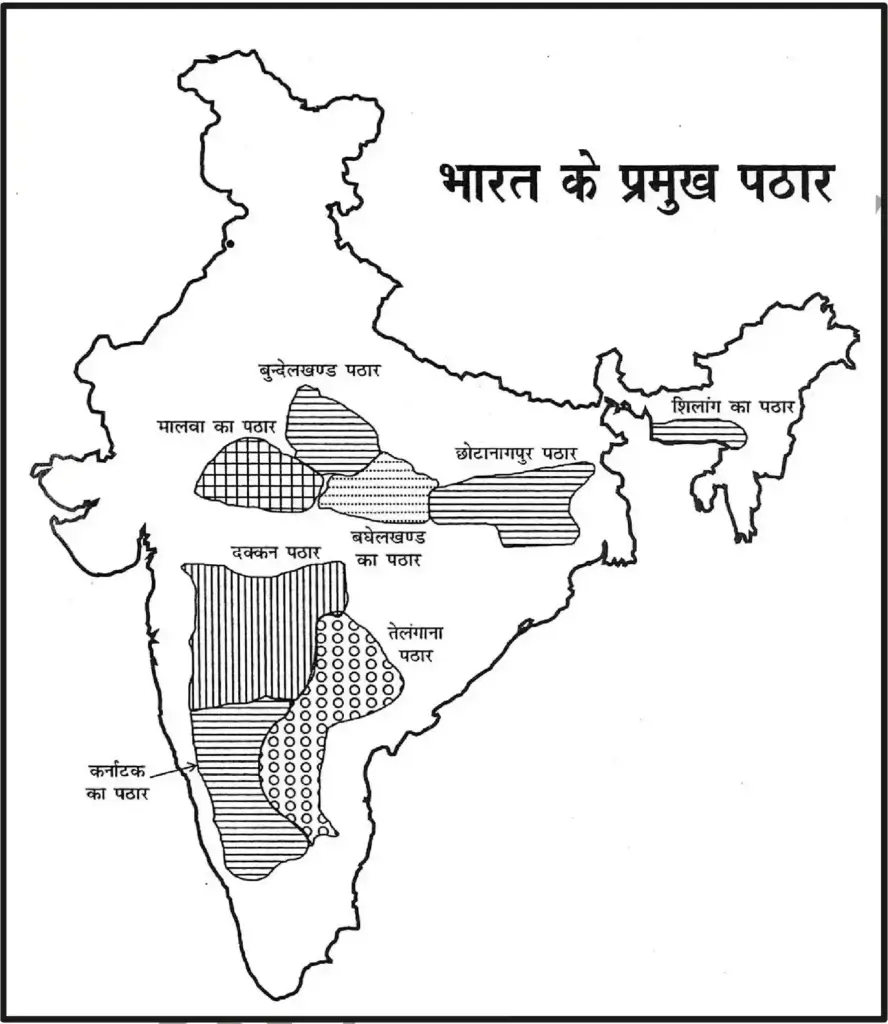
- ‘This Land Is Bounded In The North By The Ganges-Satulj Plain And In The Remaining Three Directions By The Sea.
- The Narmada Flowing In The Rift Valley Mainly Divides This Plateau Into Two Parts – The Malwa Plateau In The North And The Deccan Plateau In The South.
- The Deccan Plateau Was Formed By Lava Formation In The Cretaceous–Eocene Era.
- Rivers Like Betwa, Parvati, Kali Sindh, Mahi Etc. Flow Through The Malwa Plateau.
- The Vindhya Plateau Lies To The South Of The Malwa Plateau.
- The Bundelkhand Plateau Lies To The North And North-East Of The Malwa Plateau .
- To Their East Is The Chota Nagpur Plateau, The Largest Part Of Which Is The Ranchi Plateau. There Is A Lot Of Minerals Here.
- The Deccan Plateau Is The Largest Plateau In India.
- Under This, The Territories Of The States Of Maharashtra, Madhya Pradesh, Gujarat, Karnataka And Andhra Pradesh Come.
- Godavari River Divides It Into Two Parts
- Telangana Plateau And Karnataka Plateau.
- Its Northern Boundary Forms The Tapti River.
India Land Area » Coastal plains of india
- The Vast Plains Of India Is One Of The Most Fertile And Densely Populated Areas Of The World.
- This Vast Plain Has Been Formed By The Deposits Brought By The Rivers.
- Its Thickness Is Highest In The Gangetic Plain And Lowest In The West.
- Its Western Boundary Has Merged With The Rajasthan Desert.
- In Kerala These Plains Are Filled With Sea Water And They Become Lagoons. Here They Are Called Kayals Or Backwaters. The Largest Of These Lagoons Is The Vembanad Lake (Vembanad Samaddha) Which Is Located In Kerala.
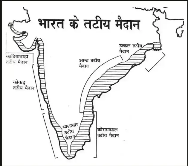
Based On The Characteristics And Slope Of The Soil, They Are Mainly Divided Into Four Parts.
- Bhabhar Region- The Plain Formed By The Himalayan Rivers Bringing The Fallen Stones And Pebbles From The Mountainous Areas Is Called Bhabhar. In This Water Does Not Stagnate On The Surface.
- Terai Region- The Terai Region Extends Below Bhabhar. It Is A Low Flat Plain, Where The Waters Of Rivers Form Marshy Areas Here And There.
- Bangar Pradesh- It Is Formed From The Old Alluvial Soil Brought By The Rivers. It Also Contains Pebbles Which Are Made Of Calcium.
- Khadar Pradesh- It Is Formed Every Year From The Soil Brought By The Rivers. Its Fertility Is The Highest.
India Land Area » the islands of india
The Longest Coast Line In India Is In The State Of Gujarat, Then In The State Of Andhra Pradesh And Then In The State Of Maharashtra.
*Indian Border Includes The Following Islands
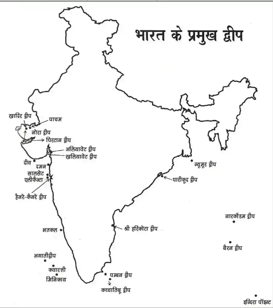
Andaman And Nicobar Islands Group
- This Group Of Islands Is Located In The Bay Of Bengal.
- There Are 204 Islands In The Andaman Group, Of Which Middle Andaman Is The Largest.
- It Is Believed That These Island Countries
- It Is An Extension Of A Mountain Range Located To The North-East Of.
- Candle Peak (Sadale) Located In North Andaman
- Peak) Is The Highest (737 M) Peak.
- There Are 19 Islands In The Nicobar Group, Including The Great
- Nicobar Is The Largest.
- Great Nicobar Is Located To The South And Only 147 Km From The Indonesian Island Of Sumatra. Are Far
- Barren And Narcondam Are Volcanic Islands That Form The Andaman And Nicobar Islands.
- Located In The Group.
- Duncan Passage Is Between South Andaman And Little Andaman.
- The 10 Degree Channel Is Between Little Andaman And Car Nicobar. It Separates Andaman From Nicobar.
Lakshadweep Group
- This Island Is Located In The Arabian Sea.
- There Are 25 Islands In This Group. All These Coral Islands
- (Coral Islands) And Coral Reefs
- Reefs).
- There Are Three Main Islands – Lakshadweep (In The North),
- Minicoy (In The South), Kavaratti (In The Middle).
- The 9 Degree Channel Separates The Kavaratti From The Minicoy.
- The 8 Degree Channel Separates Minicoy Island (India) From Maldives.
India Land Area » himalaya mountains
Himalaya is a mountain range located in the east northeast
India Land Area » peninsula plateau of india
Aravalli Mountains, Vindhyachal Mountains, Satpura mountain, Western Ghats or Sahyadri, Eastern Ghats, Nilgiri or Blue Mountains
India Land Area » deccan plateau of india
The Deccan Plateau is the largest plateau in India., The Deccan Plateau was formed by lava formation in the Cretaceous–Eocene Era.
India Land Area » coastline of india
The Great Plains of India is one of the most fertile and densely populated areas of the world.
The longest coast line in India is in the state of Gujarat, then in the state of Andhra Pradesh and then in the state of Maharashtra.
India Land Area » the islands of india
Andaman and Nicobar Islands, Lakshadweep Group


