Introduction to maps | Definition, Examples, Diagrams
Meaning And Definition Of A Map
Showing The Surface And Cultural Features Of The Whole Or Part Of The Earth On Paper Or A Flat Surface Is Called A Map. Map Is Derived From The Latin Word Mappa. The Map Is Kept Separate From The Photographic Picture. The Actual Shape Of An Object Or Place Comes In The Photograph. Whereas The Various Details To Be Shown In The Map Are Indicated By The Custom Symbols.
Fj According To Mock House (According To FJ Monk House): ‘Map Is The Representation Of The Features Of A Part Of The Surface On A Plane Surface According To A Fixed Scale.’
According To Stanley White (According To Stanley White): Map Is A Simple Picture On Which The Shape Of A Country Or Region Is Depicted On A Flat Surface.
Maps Of Purpose ( Purpose Of Maps )
The First Purpose Of The Map Is To Convert The Various Natural And Human Features Found On The Earth Into Smaller Sizes According To The Scale And Make Them Understandable. Because Our Earth Is So Big That It Is Not Possible To See It With Eyes At Once.
Various Types Of Landforms Such As Mountains, Plateaus, Plains, Lakes And Rivers, Soils And Climate As Well As Many Types Of Human Activities Are Found On The Surface. The Purpose Of The Map Is To Show All These Types Of Facts. Apart From This, Invisible But Important Patterns On The Surface Can Also Be Shown Through Maps.
Although Many Statistical Diagrams Are Also Used For This Task But They Are All Secondary Methods. A Map Is A Suitable Method To Represent All This.
Maps Need And Use (Needs And Uses Of Maps )
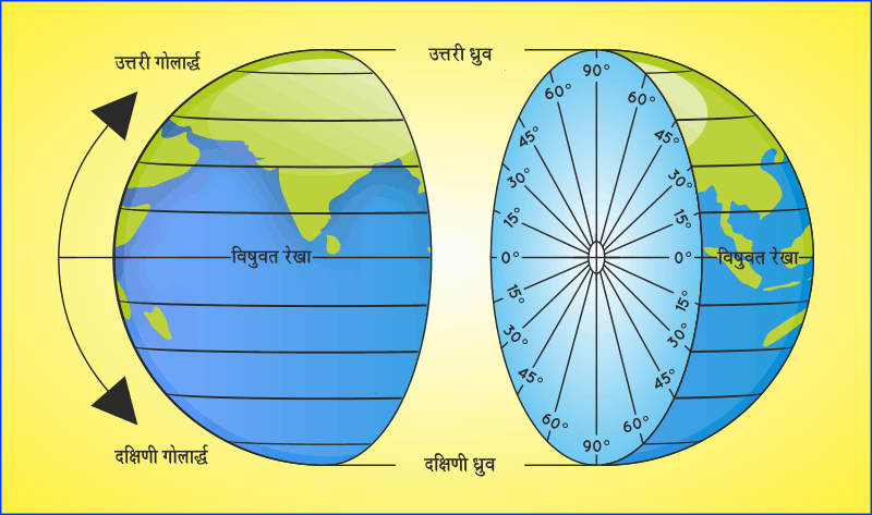
In Fact, The Globe Itself Displays The Shape Of The Earth Correctly, But There Are Many Difficulties In The Study Of The Globe Such As 1. Due To The Globe Being Round In Shape, It Is Not Possible To See Both The Different Continents And Oceans Shown On It At The Same Time, Due To Which A Common Man Cannot Understand The Exact Position Of The Continents And Oceans Spread On The Earth. Whereas The Entire Earth Can Be Seen At A Glance By The Map.
Due To Being Very Small In Globe Shape, No Area Of The Earth Can Be Shown In Detail On Them, Whereas It Is Possible To Study The Smallest Area In Detail By The Map.
3. Comparative Study Of Any Two Areas Of The Earth Can Be Done By The Map, Whereas It Is Not Possible By The Globe.
4. It Is Easy To Measure The Distance Of Any Two Places On The Map Whereas This Task Is Quite Difficult On The Globe. Maps Are Used To Show The Economic, Social, Cultural And Political Activities Of Human Beings. Keeping In View The Use Of The Map, It Has Been Called ‘Geographer’s Tool’.
Apart From Geography, The Use Of Maps Is Also Increasing In Subjects Like Geology, Climatology, Meteorology, Oceanography, Botany, Astronomy, History, Agriculture Etc. After The First World War, The Use Of Maps In The World Has Increased Significantly, The Use Of Maps Is Also Shown By Hitler’s Statement ‘Give Me A Map Of Any Country, I Will Conquer That Country.’ Map Shows As Much Information As Possible In The Least Number Of Places.
Dr. HR According To Mill (Dr. HR Mill) “This Principle Should Be Accepted That What Cannot Be Mapped In Geography Cannot Be Described.”
Maps Of Classification ( Classification Of Maps )
The Classification Of Maps Can Be Done On Many Bases Such As Scale, Purpose, Quantity Of Topographical Feature, Content And Method Of Construction, But Mainly The Main Basis Of Classification Of Maps Are Scale, And Purpose, Which Are Described Below.
Classification Of Maps On The Basis Of Scales
Maps Are Divided Into Two Classes According To The Scale. (I) Large Scale Map And (Ii) Small Scale Map. Maps Are Of Four Types On The Basis Of Big And Small Scale.
(A) Cadastral Maps: These Maps Are Made On A Large Scale, That Is, The Detailed Description Of A Small Area Is Shown In These Maps. Such As Village Maps, City Maps, Public And Personal Land Area Maps, Etc. These Are Also Called Government Maps.
Because Land Property Maps Are Made By The Government For Various Types Of Tax Collection, Town Planning, Rural Land Use Etc. The Scale Of These Maps Ranges From 1 Cm: 40 Meters Or 1 Inch: 110 Yards To 1 Cm: 20 Meters Or 1 Inch: 55 Yards.
(B) Topographical Maps According To The Survey Of India, Topographical Maps Are Those Maps In Which The Position And Shape Of Each Feature Shown On The Map Can Be Identified Above The Surface Of That Feature. These Maps Are Also Made On A Large Scale.
Through These Maps, Relief (Mountains, Plateaus, Plains), Flows, Vegetation, Villages, Cities, Different Types Of Transport Routes And Canals Etc. Are Shown. These Maps Are More Useful For Detailed Study Of A Small Area. Before The Introduction Of The Metric System, These Maps Were Made On The Scale Of Inches: 1 Mile, 1 Inch: 2 Miles And 1 Inch: 4 Miles, But After The Adoption Of The Metric System, These Maps Were Made At 1:25,000 And 1:50,000 Scale. But Have Been Built.
(C) Wall Maps These Maps Are Also Called Geographical Maps. They Represent The Whole Or Any Part Of The Earth. The Maps On The Walls Of Schools And Colleges Also Come Under This Category.
Many Natural Or Human Characteristics Of The Vast Area Can Be Shown By These Maps, Such As Climate, Types Of Forests, Distribution Of Minerals, Population Distribution, Distribution Of Different Types Of Crops Etc. These Maps Are Made On A Small Scale. This Map By The Survey Of India Is From 1: 15,000,000 To 1: 2, 500,000 Or 1 Cm: 5 Km. From 1 Cm: 40 Km. Made On A Scale.
(D) Atlas Maps Only The Main Natural And Human Features Of Continents Or Regions Are Shown Through These Maps. Because Atlas Maps Are Also Made On A Small Scale. Therefore, It Is Not Possible To Show Small Features On The Map. Atlas Maps Are Usually Made On A Scale Smaller Than 1:15,00,000.
The English Version Of The National Cartography Of India Has Been Prepared On 1:1,0,00,000 Scale. Atlas Maps Are Very Useful For Teaching Work, Through These Maps, Various Physical And Cultural Features Of The Whole World, Continent Or Any Country Can Be Seen At A Glance.
(2) Classification Of Maps According To Purpose Or Subject Matter
Maps Are Divided Into Two Categories Based On Purpose Or Subject Matter.
(A) Preliminary Or Physical Map
(B) Human Or Cultural Map.
(A) Natural Or Physical Maps
The Following Maps Are Classified As Natural Or Physical Maps. I
1 Astronomical Maps These Maps Show The Celestial Positions Of Celestial Constellations, Nebulae, Planets, And Satellites, Etc.
II Geological Maps : By These Maps The Structure Of An Area And Its External Contours Are Shown.
III Seismic Maps This Map Shows The Seismic Center, Seismic Waves And Their Scattering.
IV Relief Maps: These Maps Show The Structure Of The Whole Or Any Part Of The Earth And The Various Topographical Features Found On It, Such As Mountains, Plateaus, Plains, Rivers, Valleys Etc.
V Climatic And Weather Maps: Various Elements Related To Climate And Weather Are Shown Through These Maps, Such As Details Of Temperature, Rainfall, Air Pressure, Direction Of Winds Etc.
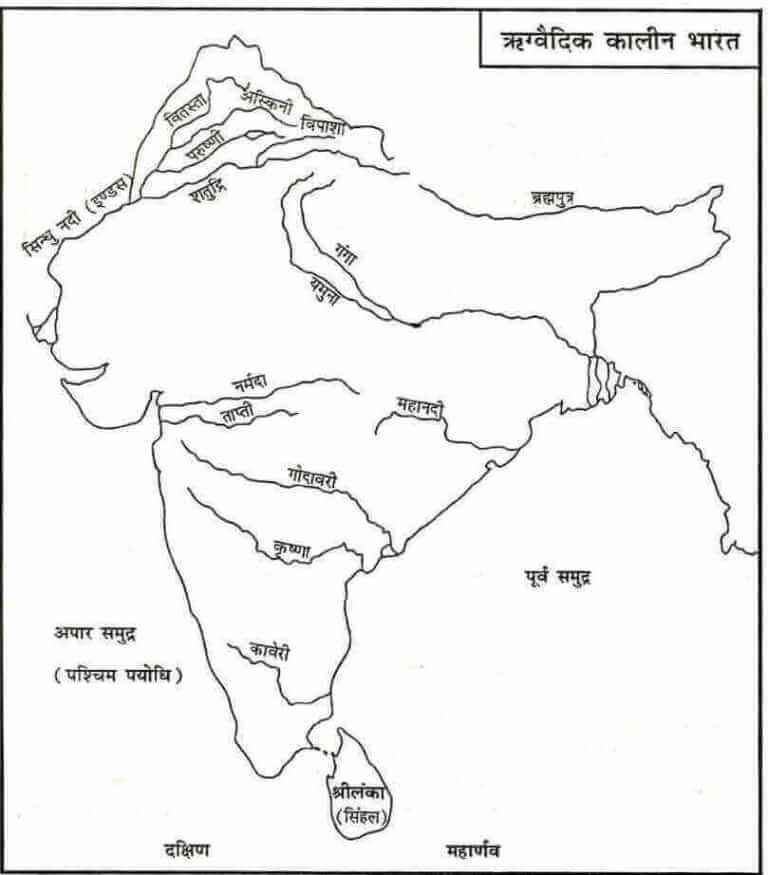
VI Drainage Maps: Through These Maps The Flow And Direction Of The Main River And Its Tributaries Are Shown.
VII Soil Maps These Maps Show The Different Types Of Soils Found In A Region.
VIII Vegetation Maps
The Distribution Of Various Natural Vegetation Found In A Region Is Shown Through These Maps.
(B) Human Or Cultural Maps
The Following Maps Are Kept In The Category Of Human Or Cultural Maps.
I Socio-Cultural Maps These Maps Show The Components Related To Human Culture Such As Caste, Language, Religion, Dress Etc.
II Population Maps: By These Maps The Distribution Of Population, Density, Growth, Sex Ratio, Age-Group, Transfer And Occupational Structure Etc. Of The Whole World, A Country Or A State Are Shown.
III Economic Maps These Maps Show The Economic Activities Of Human Beings. For Example, The Distribution Of Different Crops Is Shown In The Agricultural Map. Various Industrial Areas Are Shown In The Industrial Map. Transport Maps Depict Different Types Of Transport Routes In An Area. Mineral Maps Show The Distribution Of Minerals Found In An Area.
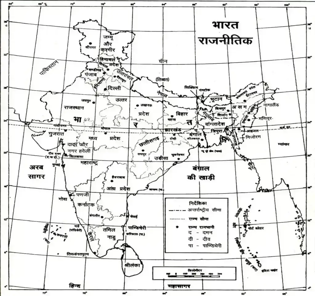
IV Political Maps: By These Maps The Political Boundaries Of The Whole World, Any Country, State Or District Etc. Are Shown.
V Historical Maps: These Maps Show The Political History Of A Country And The Events Related To It.